

|
|
|
|
|
A Heritage
and Countryside walk in and around Thurleigh
Less
than 2 miles easy (not suitable for wheelchairs etc.) If wet
walking boots recommended but not essential. The starting
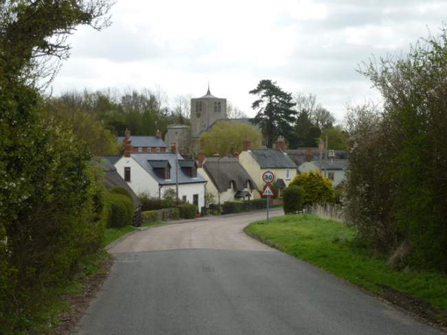
point for our walk is the Village Hall. As you face the Hall, take the
footpath
to the left and walk down the path, passing the rear of the Primary
School. There is
mention of a school as far back as 1558. By 1841 a new school was
erected on
the site where the Village Hall stands. The present school was
completed in
1877 with new classes being added in 1973. This footpath follows the
route of
the original main road through the village. Just
before you reach the bottom of the hill
turn left on a signposted path across a sleeper bridge and follow the
path to
the road. At the road
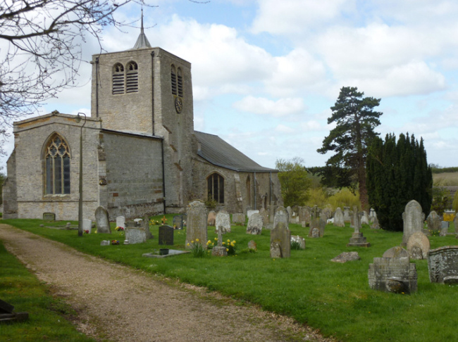
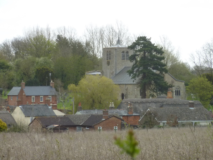
you will see St Peters Church opposite. There
has been a church on this site since Saxon Times. However the church
has been
re built several times and appears now much as it has done since the 15th
Century.
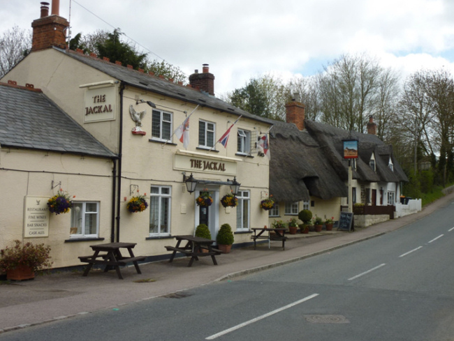
Turn
right and pause for a while outside The
Jackal.
Opposite you
will see Red Lion House. This was formally one of four Pubs in the
Village and
was named The Old Red Lion House. The
house had an annex which housed a Club Room, which for a small monthly
subscription members received sickness benefit. Any monetary balance at
the end
of the year was shared out and in addition provided a feast for members
and
their families at Christmas. The whole
building was extensively rebuilt following a fire in the 1960s. Now
carry on down the hill and up to a road on
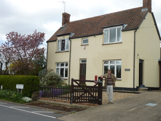
your right. Opposite you will see the old Village Post Office. This was
originally built with a thatched roof
being replaced with a tiled roof following a fire. This housed the Post
Office
and general store for 60 years before sadly closing in 2007. Turn
Right up Church End and carry on up here
as it becomes Whitwick Green Road. Follow the road uphill for a further
150
metres. Now look for a footpath sign in the hedgerow on the left. Take
this
path crossing a sleeper bridge. After about 50 metres stop and look to
your
left, you will have a good view of St Peters Church and a view of
Thurleigh
which has likely been unchanged for a couple of hundred years.
Carefully
cross the road being especially aware of speeding traffic on this
section.
Immediately opposite cross a wooden bridge and turn left. Follow this
permissive footpath around the field margin as it soon turns right
running
parallel to Mill Road. Just before you reach a house, bear left and
emerge onto
Mill Road. Again take care of speeding traffic as you cross the road
and onto a
path opposite. Follow this path, hedgerow and field edge as it turns
left then
right following the field margin down the hill in the direction of
Thurleigh.
At the tree line at the end of the field, turn right still following
the field
margin. Turn left at the first waymarker
making your way through a tree line and bearing slightly left make for
a girder
bridge and ascend the steps in the bank. At the top of the steps turn
left to follow
the track that soon turns right for a few yards, then turn left along a
field
edge. At this point the field edge should be on your right. Soon you
pass above
a small lake known as Westminster Pond below on your left.
Lads from the village used to keep cool in the summer by
swimming here. At
the end of this path, cross an access track
and heading in the same general direction make your way across an area
of scrub/meadow
towards the Church and a waymarker on the far side. Passing the side of
the
Church, emerge onto the road opposite The Jackal. Now if you have timed
it
right is the perfect opportunity to head into the Pub for some
refreshment. See
http://www.thejackalpub.co.uk/
for opening times. (closed all day Monday) To complete
the walk, head uphill back to The Village Hall. Historical
information provided with special thanks to Lillian Wildman and Judy
Stanton
who wrote Thurleigh Through The Ages. Additional information provided
by Kevin
and Jules at The Jackal, and also John and Sue Barton who formally ran
the
village Post Office and shop. For more
historical information on Thurleigh, the book Thurleigh Through The
Ages is
recommended. I hope you
have enjoyed this walk, further walks and current information about
Thurleigh
can be found by visiting www.thurleigh.net |