|
The following route was a from a set of three walks
reproduced in a leaflet in 2000, A colour map of these walks
can be found on the wall of the Village Hall,
a black and white copy is available
here
Dogs
MUST be kept on a lead at Stages 2, 7, 8, 12 and 13.
1. Start
at the Playing Field Clubhouse and walk eastward along the
inside of the field and through the gap in the hedge at the
bottom.
2.
Bear right and continue ahead to the waymarked stile on the
opposite side of the field. Over two more stiles (Beware
of Horses) and the footpath opens onto Cross End Lane.
3. Turn
left along the lane and then right at the next waymarker.
Cross the newly built footbridge and follow the hedgerow
around to the left towards the "Farm Centre". (The
freshly grown fruit on the farm attracts an abundance of
butterflies and birds, particularly partridges)
4. Where
the footpath meets the bridleway turn right through the yard
of Barns Cottage (Beware of friendly Dogs) onto
Bolnhurst Road.
5. Turn
right along the road for a short distance heading towards
the village. (The hedgerow here contains dog roses, lots
of bindweed and in the grass verge the large-leafed,
blue-flowered comfrey).
6. Turn
left onto the signposted bridleway and follow along around
the double S bend.
7. Leave
the bridleway at the waymarked turning right over the
footbridge onto the footpath to the newly built
stile.
8. Cross
the ditch and stile, turn right and follow the waymarked
route and over the next stile onto the Byway Open To All
Traffic (BOAT) which passes around Park End Farm. (Beware
of Horses) (In the past Thurleigh had a number of
quite separate "Ends" consisting of a moated farmhouse and
several cottages around a central green. Park End had
many more houses than it does at present probably because
the existing bridle path was once the main roadway to Wilden).
9. Leave
the Farm by the signposted gate on the opposite side and
follow the hedgerow until the BOAT turns into the waymarked
footpath at the piped in ditch.
10.
Continue down the open field to the bottom of the hill (Thurleigh
/ Ravensden Parish Boundary) where the footpath turns right
onto the hardcore track. Turn right again and follow the
track, with the brook on the left, to the derelict buildings
at Brook Farm.
11. Cross
the footbridge opposite the farm and continue, with the
brook now on the right, until the footpath reaches the road
known as "Robins Folly". The origin of this name is unknown.
12. Cross
the Folly onto the signposted footpath, continue along the
hedgerow and brook, (the wildflower speedwell is
prevalent here) turn right over the footbridge and
proceed up the left hand side of the hedgerow.
13. Go
through the gate, over the ditch, and follow the waymarked
footpath along the course of the brook all the way back to
the village. (As the village is approached the 17th
century Bury Farm lies immediately ahead. Behind the
Farm is the castle mound known as Bury Hill which is
scheduled as an ancient monument. No written records exist
for the castle and it is probable that it was built around
1140AD without the king's permission. Little masonry stone
has been found in the area which could mean that the castle
was predominantly built of timber and clay or the stone may
have been used in later years to rebuild the church).
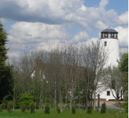
14. The
footpath comes out alongside the churchyard wall onto the
High Street almost opposite the "Jackal". Cross the street
and follow the signposted footpath straight ahead, turn
left and then right at the respective waymarkers and
continue along the field edge, keeping to the right hand
side of the brook, as far as the Sewage Treatment Works.
15.
Immediately past the works turn right along the fence and
exit onto Keysoe Road. Turn right down the road, past the
American War Memorial, and then left into the Playing
Field. (The Memorial to the American airmen who
died in the second world war was erected and dedicated in
1982 when more than 100 veterans from the former Thurleigh
base attended).
The
leaflet this walk was taken from was prepared by Thurleigh
Parish Council and Village Members of the Parish Paths
Partnership in conjunction with much appreciated assistance
from the Environmental Service Officers at Bedfordshire
County Council and The British Trust for Conservation
Volunteers (B.T.C.V.). Most of the information about the
village has been taken, with the kind permission of Mrs Judy
Stanton and Mrs Lilian Wildman, from their booklet "Thurleigh
Through The Years" published in 1998.
See all public
footpaths, bridleways and byway open to all traffic (BOAT)
on the
Bedford Borough Council Website |